Where was the Alamo’s 18-pounder cannon located? Where was Travis’s headquarters, where he wrote his famous “Victory or Death” letter, and where did Davy Crockett and Jim Bowie die? And the biggest question of them all: how big was the Alamo? These are some of the most frequently asked questions by visitors to this historic site.
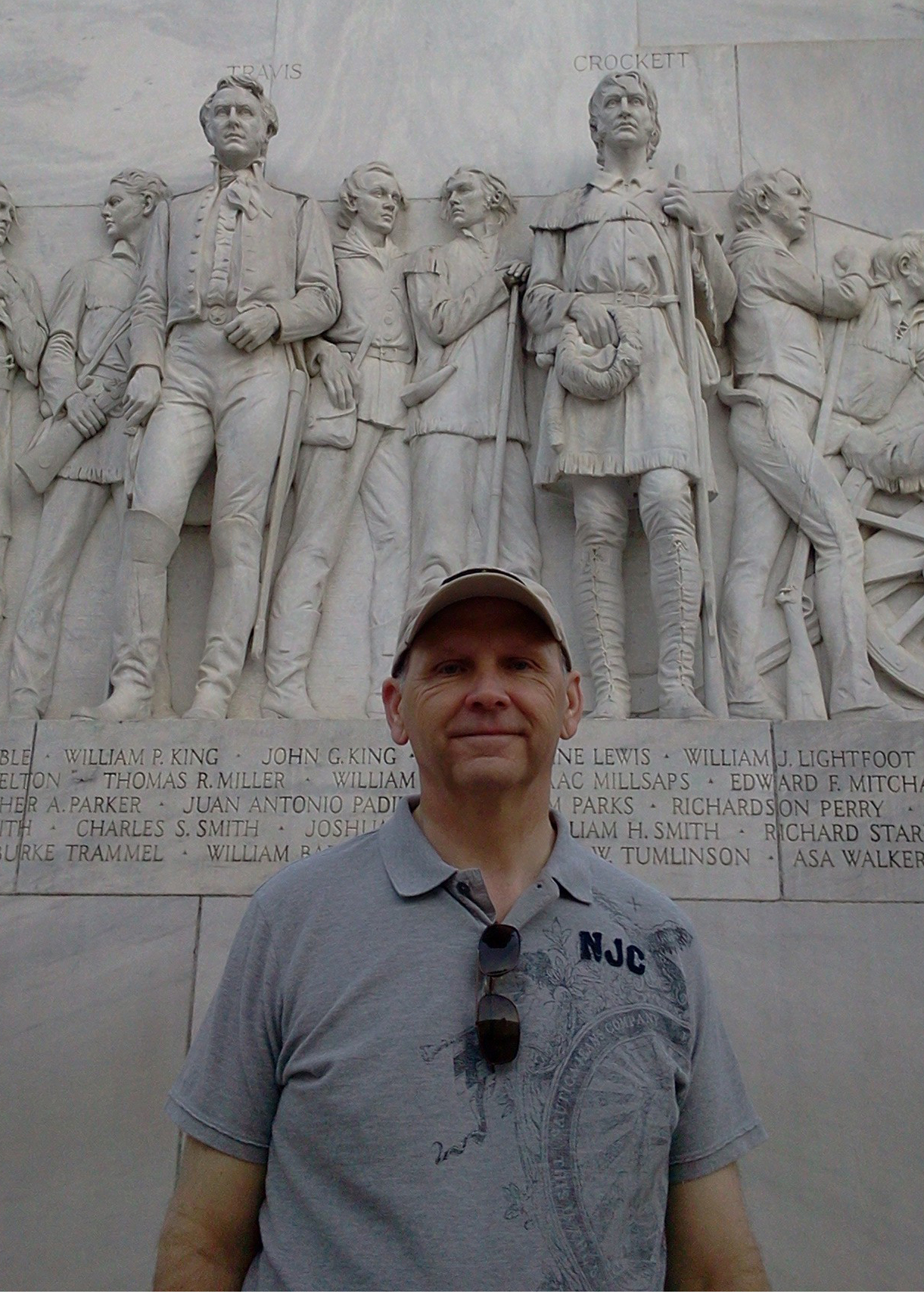
These mysteries arise from the growth of the City of San Antonio, which has significantly obscured a major portion of the Alamo’s original battlefield. So, does this mean that finding those sites is impossible? No. Many of the sites are well marked and hidden in plain sight; you just need to know where to look. And it’s for that reason I wrote this post: to help you navigate around today’s city streets to find “the Alamo.”
However, since I first wrote DISCOVERING THE ALAMO, PART 1: THE ALAMO’S COMPOUND in 2019, much has changed on the old fort’s grounds. In those seven years, thanks to the Texas General Land Office (GLO) and the Alamo Trust, Inc. (ATI), who operate the Alamo, great strides have been made in bringing the Alamo to life.
However, there are still sites of the 1836 battle, like the North Wall, where Travis was killed, that need to be revealed. And that’s why I’ve updated this post to showcase what’s new and point out what’s still hidden.
So, without further ado, let’s go and “Remember the Alamo!”
Discovering the Original Alamo
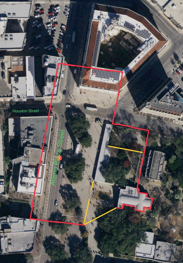
Finding the real Alamo can be a challenge for the casual visitor. In fact, when you’re standing on Alamo Plaza gazing at “The Alamo,” you’re already inside this historic fort. Because what is thought to be the ”Alamo” is really the old mission’s church.
What most don’t realize is that the original Alamo complex, with its walls and buildings, covered nearly three acres. And what we see today is only about 10% of the battlefield, with the rest having been engulfed by San Antonio’s growth over nearly two centuries.
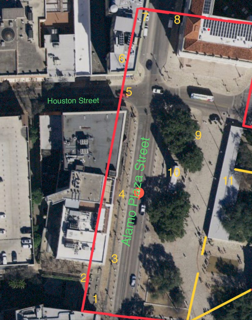
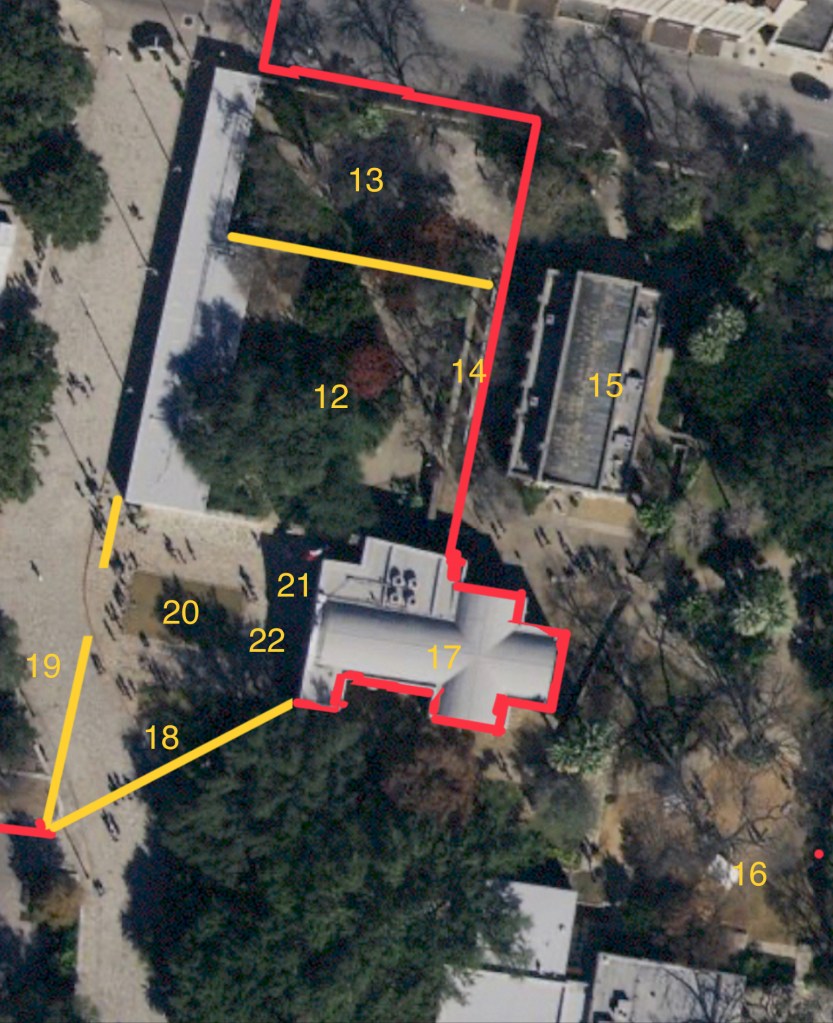
To get a visual sense of the size of the Alamo compound, I used Google satellite imagery and added lines to mark the fort’s walls and buildings. I also enlarged different map sections, numbering the historic sites. All to help you when you visit to discover the Alamo.
The Alamo’s Southwest Corner and the 18-Pounder Cannon
We’ll begin our exploration at the fort’s southwest corner (see map #1). It was here that the Alamo’s largest cannon, its iconic 18-pounder, was positioned. On February 23rd, 1836, the first day of the siege, Alamo Commander Colonel William Travis used this cannon to answer Santa Anna’s demands to surrender.

When I was at the Alamo in 2018, this area was composed of oddly shaped, light-brown brick walls that marked the foundations of what’s believed to have been the Losoya house and the fort’s blacksmith shop. However, in his The Illustrated Alamo 1836, Mark Lemon refers to these buildings as the Charli house, the carpenter shop, or the artillery command. Also, in 2018, there was a glass-in display there where you could actually see one of the original building’s foundations.
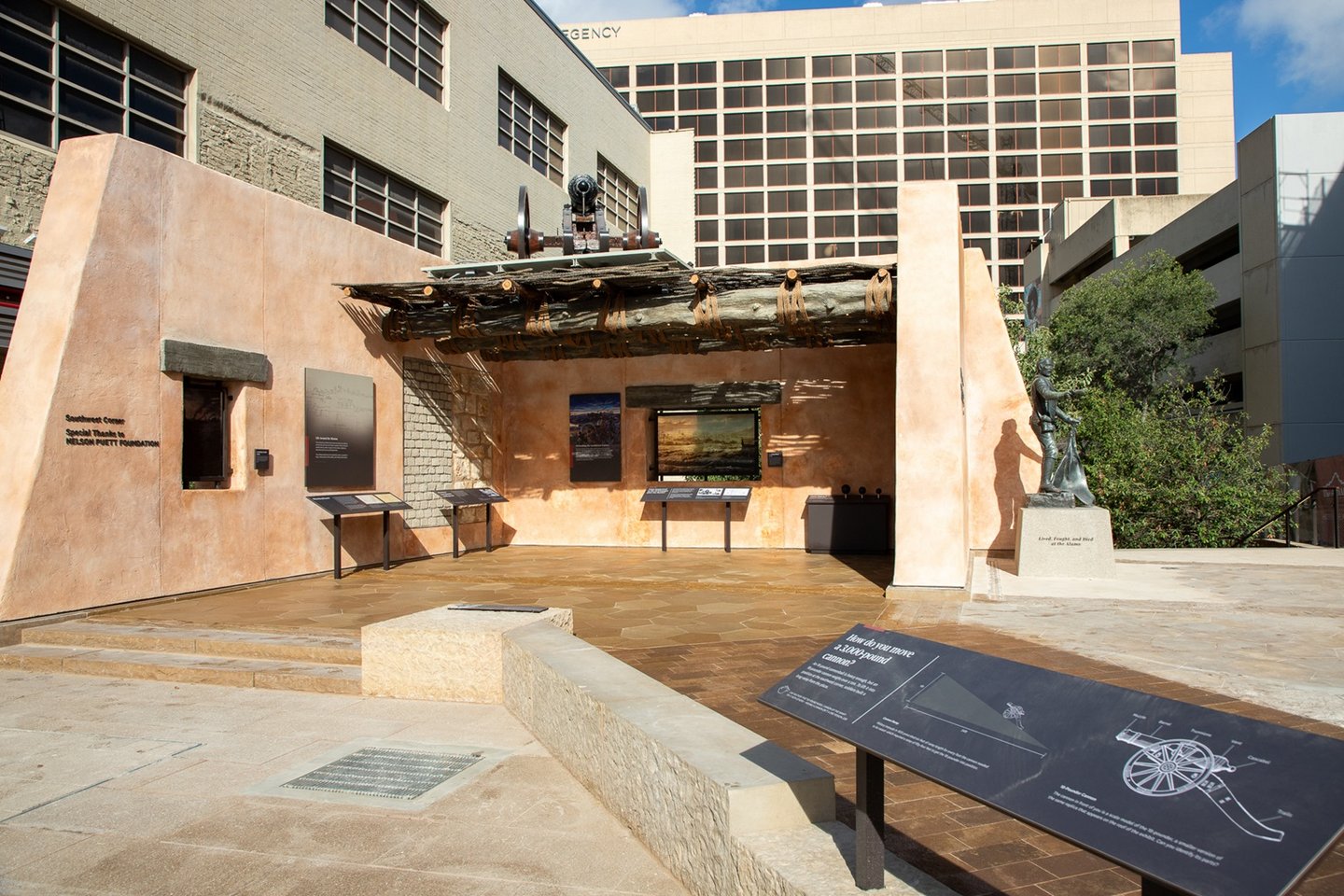
In April of 2021, a temporary 18-Pounder/Losoya House Exhibit was constructed on that site. Then, in July of 2026, the new Southwest Corner and 18-Pounder Cannon Exhibit opened. This exhibit, with a replica of the 18-Pounder mounted on top, offers a better understanding of how that section of the fort was strategically important.
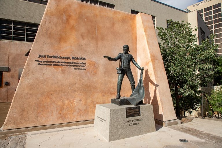
Also, as part of that exhibit, is a statue of Toribio Losoya. Losoya was born inside the Alamo near that area. Losoya was one of the defenders who fell in the battle. This statue was originally located on Losoya Street.
Paseo del Álamo (see map #2)
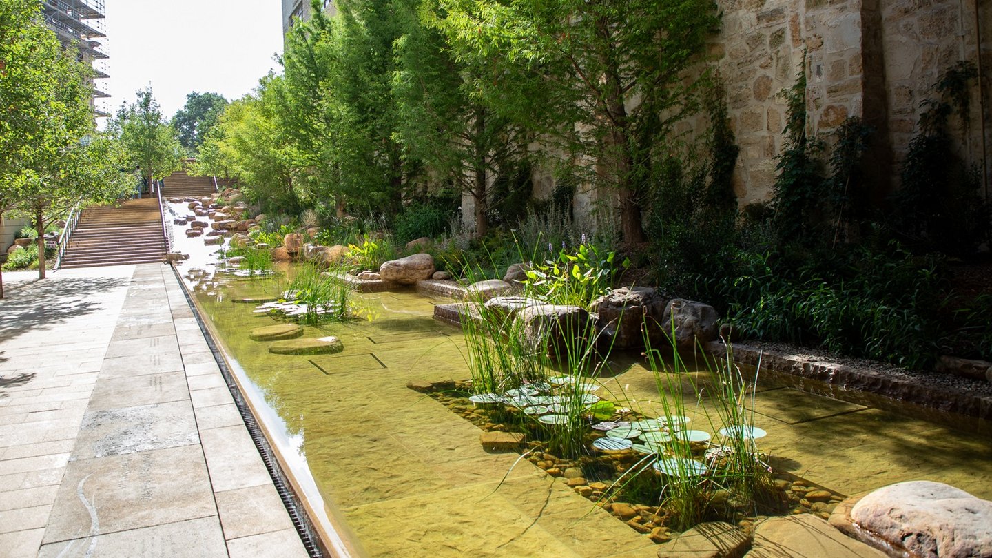
When I first visited the Alamo back in 1986, I reached it from the San Antonio River Walk by going through the lower lobby of the Hyatt Regency Hotel, up a few steps, and past a waterfall. And there she was.
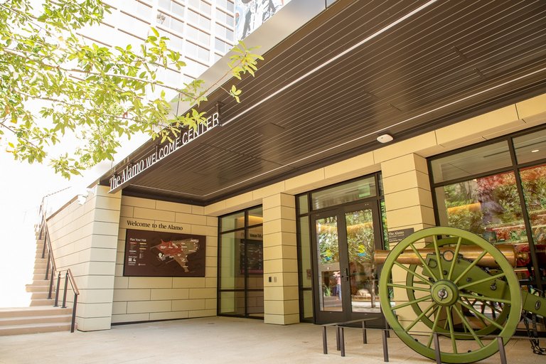
As part of the renovations to make the Alamo more accessible, this walkway has been completely reworked and is now called the Paseo del Alamo. Also, to help those arriving at the Alamo via the River Walk, a new welcome center has been opened there.
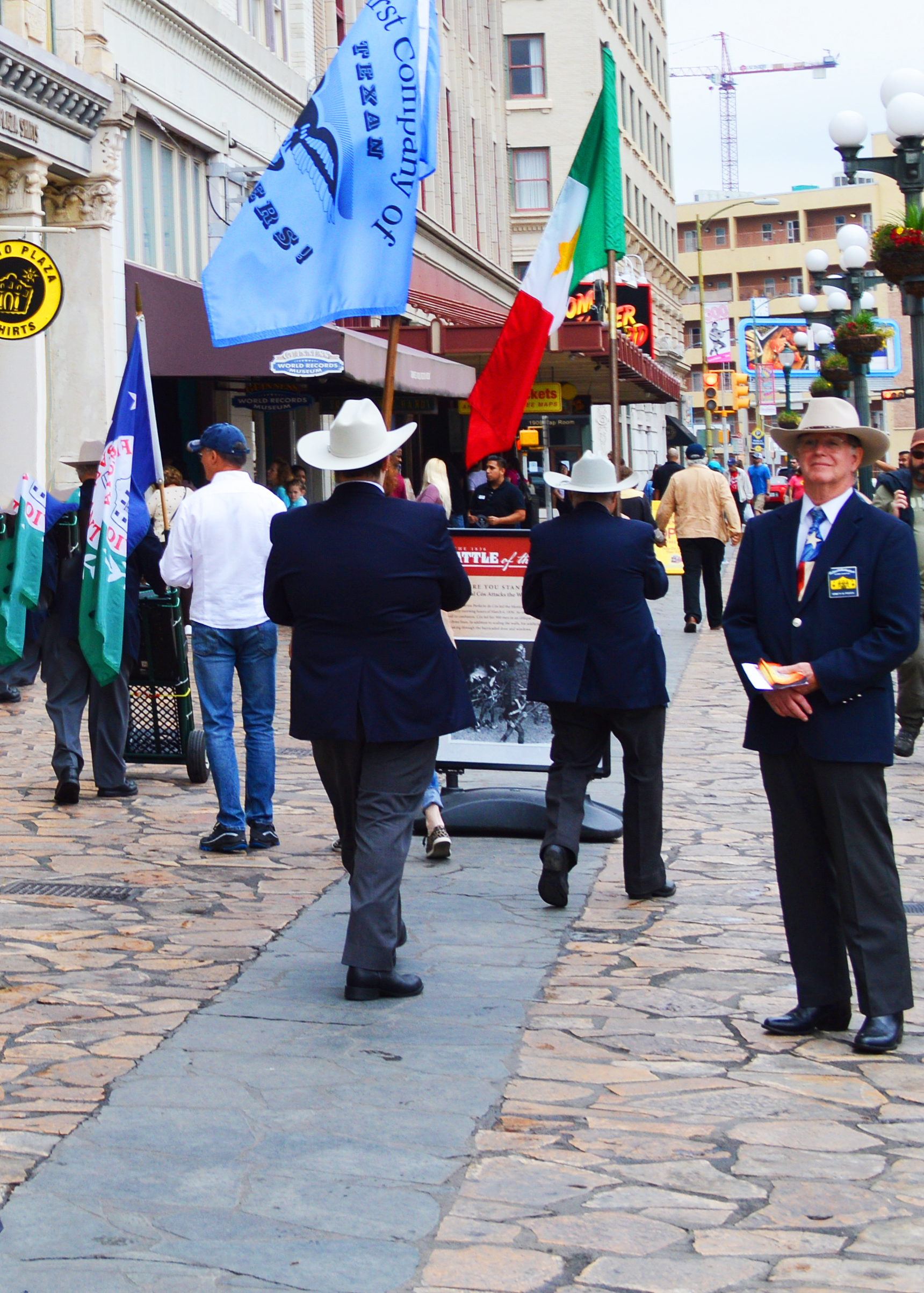
Before we go and explore the Alamo’s West Wall, I need to mention a landmark that may no longer exist. During my visit in 2018, the Sons of the Republic of Texas (SRT) guide pointed out a wide line of dark paver stones embedded in the sidewalk running north along the west side of Alamo Plaza Street (see map #3). The guide told us that this line indicated the location of a dry irrigation ditch that had run along the inside of the fort’s west wall at the time of the battle. With all the construction going on for the new museum and welcome center, I’m not sure if this still exists.
The Alamo’s West Wall
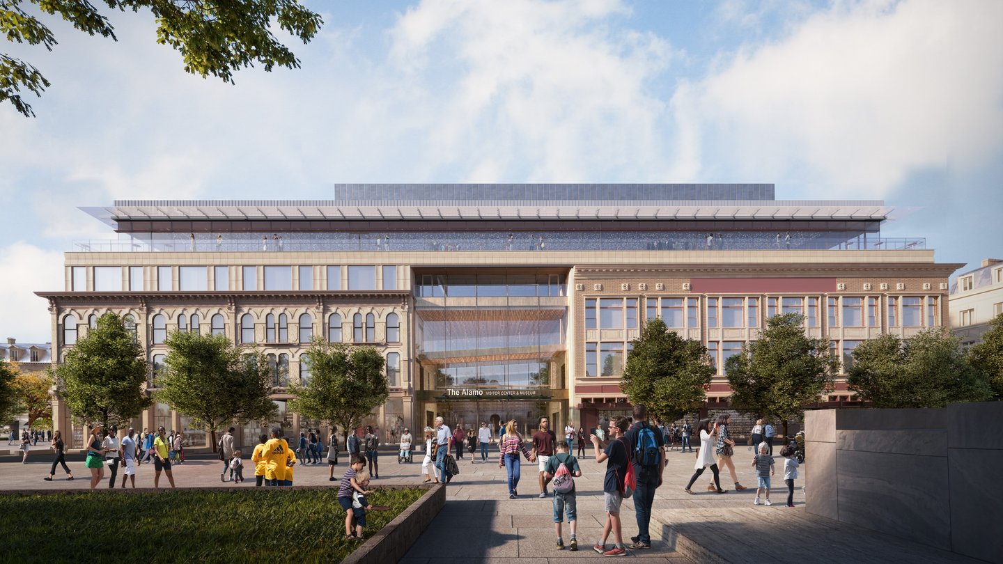
We’re now going to leave the fort’s southwest corner and head north toward Houston Street. Due to the construction of the new Visitor Center and Museum, we’ll need to cross over to Alamo Plaza. As we go, I’ll give a short history of the Alamo’s west wall.
It must be noted that the Alamo was not built as a fort, but rather a Spanish mission, the Mission San Antonio de Valero. It wasn’t until around 1758, due to other missions suffering from Indian attacks, that an eight-foot-high, two-foot-thick wall connected the family houses along the west side of the mission’s grounds. This wall was also extended along the north end of the mission, connecting it with the buildings on the east side of the grounds. This, along with a fortified gate, completely enclosed the mission’s complex. Thus, creating somewhat of a fort. And although it helped against Indian attacks, it didn’t stop Santa Anna’s soldiers.
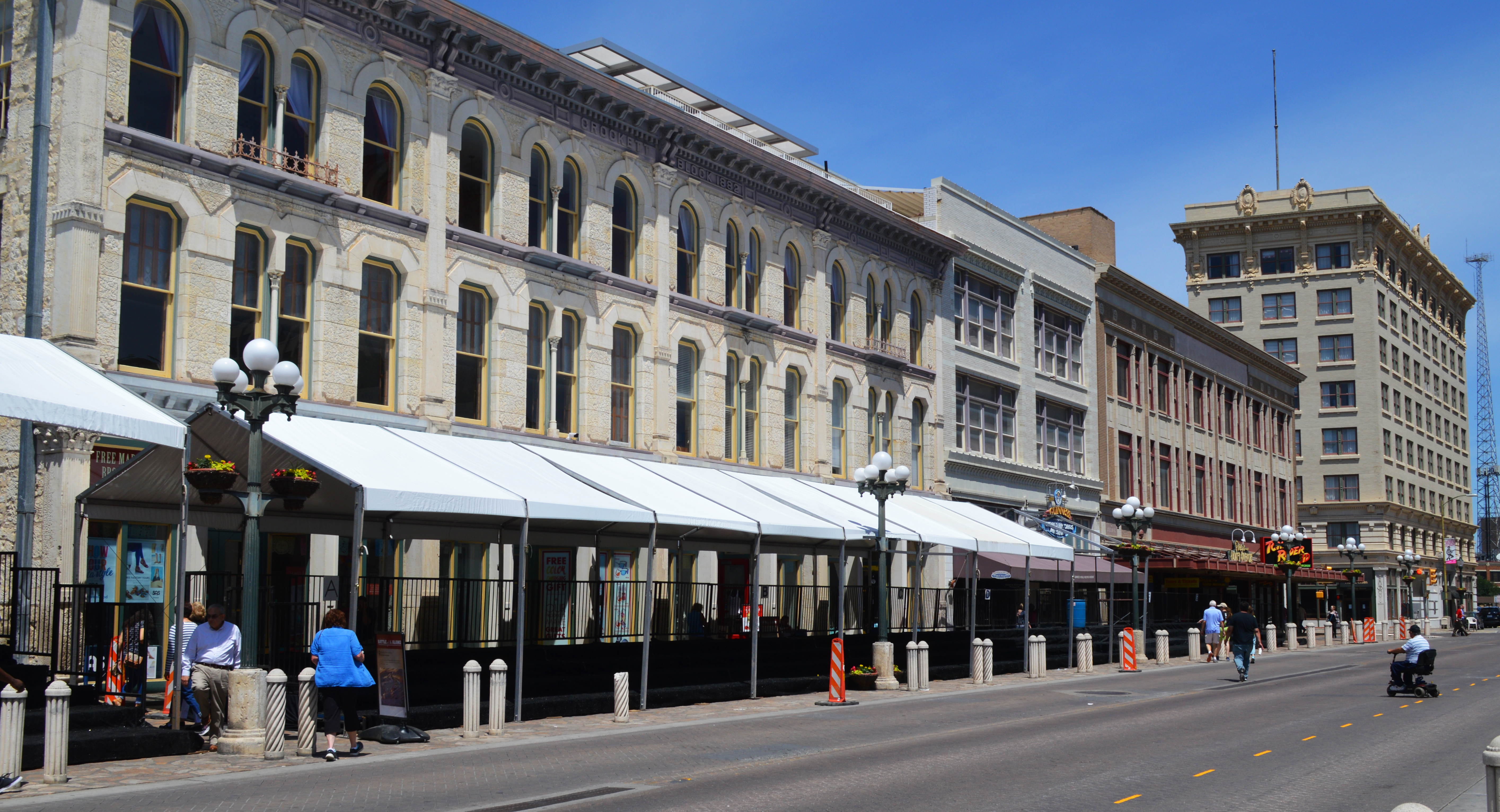
After Santa Anna was defeated at the Battle of San Jacinto on April 21, 1836, the Mexican soldiers stationed at the Alamo were ordered to destroy the fort’s defenses. Although they leveled the connecting walls, they left some of the western buildings that eventually would be rebuilt and lived in.
In 1838, only two years after the fall of the Alamo, Samuel A. Maverick, who left the Alamo as a courier during the siege, began buying up the land of the Alamo compound. In his developments, Maverick would demolish whatever traces of the west wall remained.
Over the years, a series of buildings would occupy the site of the fort’s west wall: the Crockett Building, built in 1862; the Palace Theater, built in 1923; and the Woolworth Building, built in 1921. These buildings housed the most controversial businesses on that hallowed ground: Ripley’s Haunted Adventure, Guinness World Records, and the 3D Tomb Raider. Happily, these eyesores soon vanished in 2015, when the Texas General Land Office (GLO) purchased these three buildings for $14.4 million. This would lay the groundwork for a most ambitious project.
Scheduled to open in the spring of 2028, the old fort’s west wall will be home to a 160,000-square-foot state-of-the-art Visitor Center and Museum (see map #4). This complex will extend from the Paseo del Alamo north to E. Houston Street.
One of the most important sites of the west wall is Travis’s headquarters. However, due to construction for the new museum, I’m not able to pinpoint its location at this time. Stay tuned.
The Castaneda House
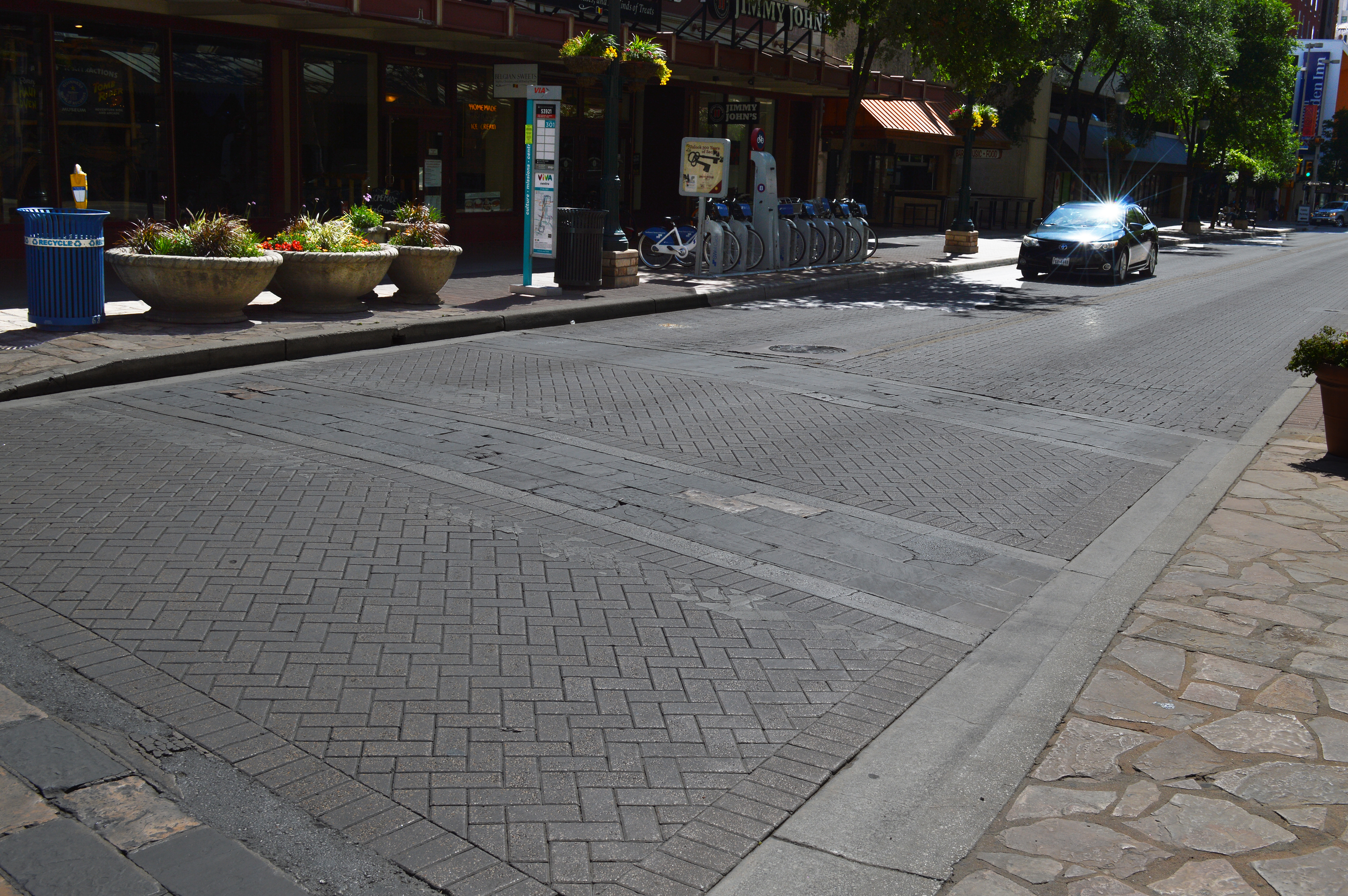
When you reach the end of the block, look down at the pavement on Houston Street (See map #5). Once again, you’ll see darker pavers. Until I took the SRT tour, I thought these were pedestrian crosswalk markings; however, I was wrong. These markings indicate the foundations of what was most likely the Castaneda House. During the battle, this house was already in ruins, and it was believed to have housed a 6-pounder cannon.
The Hotel Gibbs
We’re going to continue north, crossing Houston Street. On the northwest corner is the small boutique Hotel Gibbs (See map #6). Hotel Gibbs now occupies what was originally the Gibbs Building. The Gibbs Building was constructed in 1909 by Colonel C C Gibbs. With its eight floors, the Gibbs Building was the first high-rise in San Antonio.
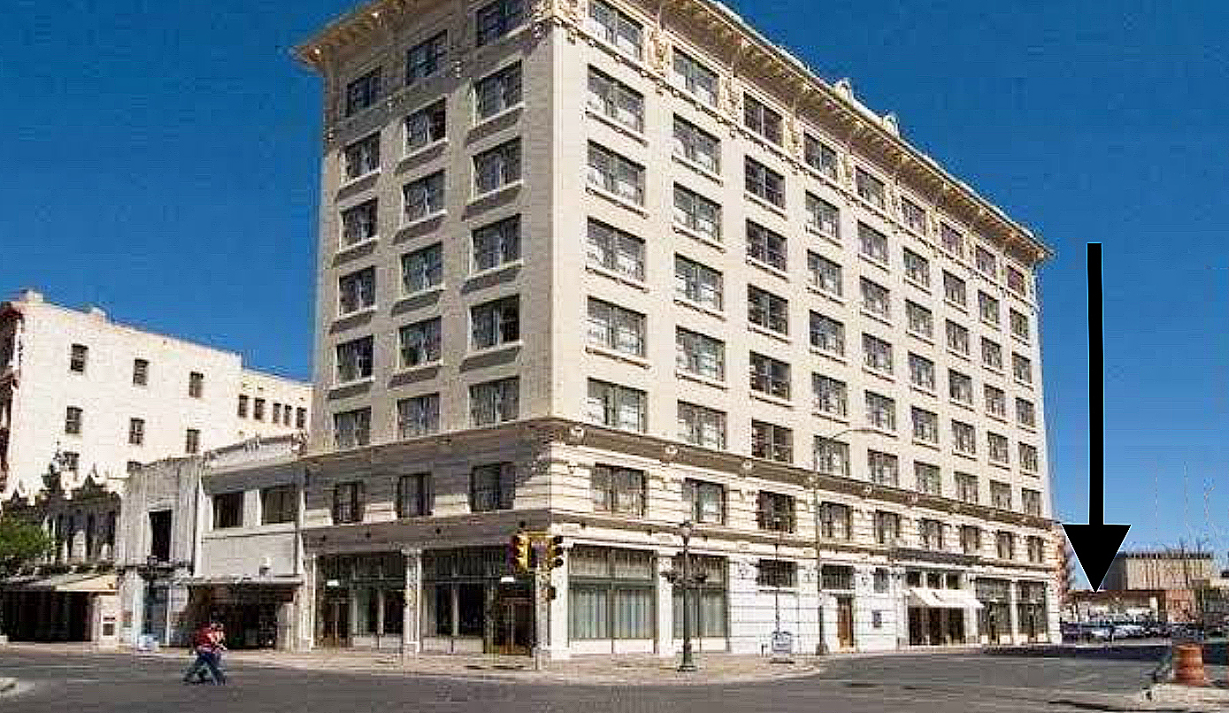
There’s also another piece of Alamo history that happened at this spot. Col. Gibbs had built his office building on what was the site of the home of one of San Antonio’s most famous developers, Samuel Maverick. It was while Maverick was excavating for his house in 1852 that he discovered a trove of Alamo cannons that the Mexican Army had buried there after the Battle of San Jacinto. These cannons have been recently restored and are on display at the Alamo. I’ll tell more about this later in this post.
The North Wall
As we continue walking north toward the rear of the hotel, keep your eye on the sidewalk. Near the back of the building, you see a small brass marker embedded in the sidewalk (See map #7). Although not as large as the others we’ve seen so far, it may be one of the most important in understanding the accurate scale of the Alamo fort.

This small metal marker has an angled line: one end pointing south and the other pointing east. It reads ALAMO MISSION ORIGINAL PROPERTY CORNER. This indicates where the Alamo’s west and north walls met. However, this marker isn’t entirely in the correct location. The actual location is several feet west, inside the Gibbs Hotel. But it does give a sense of how far back from Alamo Plaza the north wall was. There’s another marker that shows where the Alamo’s north wall had been. To locate that, we need to cross to the east side of N Alamo Street.

On the east side of the street is the massive Hipolito F. Garcia Federal Building and U.S. Courthouse. Built in the mid-1930s, as part of the WPA program, it has a polygonal design and is constructed of Texas Pink granite and Texas Cream limestone. Not only does the Garcia building encompass an entire city block, but it also occupies a good portion of where the Alamo’s north wall was.
Again, on the sidewalk, just a few steps back from the building’s side entrance, is another small metal marker (See map #8). This one has a line pointing east and west that reads, ALAMO MISSION ORIGINAL PROPERTY LINE. A very underwhelming description of what actually happened there.

It was here, during Santa Anna’s pre-dawn attack on Sunday, March 6, 1836, that the masses of Mexican soldiers finally overcame the defenders, rolling over the north wall, and gaining the inside of the fort. It was also here that William Travis gave his life.
If looking back toward Alamo Plaza, you’ll see how far removed this historical spot is from what’s known as “the Alamo.”
Now that we’ve been to the furthest northern location of the original Alamo’s grounds, it’s time to head back to Alamo Plaza and the Long Barrack building.
Alamo Plaza

Today, Alamo Plaza (See map #9) is a large and active city park, but it was much, much larger during the battle. Taking into account the entire area from the north wall back to where we started, and adding the portions inside the buildings along Alamo Plaza Street, the compound would have measured around 462 feet long by 162 feet wide.
The modern Alamo Plaza was created by Samuel A. Maverick. Maverick bought up most of the Alamo’s land and then subdivided it for his commercial and residential developments. Maverick created the plaza to be a gathering place for city residents and deeded it to the City of San Antonio. This plaza has seen it all: chili cook-offs, longhorn cattle, street preachers, political rallies, and loud protesters.
This usage of Alamo Plaza has been a hot topic of criticism by those who see this area as hallowed ground. And why passions run high, and rightly so, is because of what happened there in the pre-dawn of March 6th, 1836.
That morning, after the Mexican soldiers breached the north wall, they advanced across this open space, causing the defenders to fall back into the Alamo’s Long Barrack and the houses along the west wall. It was in this open area where many of Santa Anna’s men lost their lives.
While still owned by the City of San Antonio, Alamo Plaza is very much part of a 50-year operational agreement between the city and the Texas General Land Office (GLO). Under the agreement, the GLO will manage both of the Alamo’s original buildings and the newly purchased west wall buildings, which will house a world-class multimedia museum, and will be responsible for the overall management and reclamation of the Alamo’s historic battlefield. But this agreement has come under criticism.
One historic outcome of this agreement is that, for the first time since the Catholic Church owned these grounds, a single entity has control over the original Alamo compound.
The Alamo Cenotaph

Near the center of Alamo Plaza stands the inspiring 60-foot-tall gray Texas granite Spirit of Sacrifice monument (See map #10). Most commonly known as the Alamo Cenotaph (meaning “empty tomb”), it was constructed in 1936 to commemorate the 100th anniversary of the Battle of the Alamo. Dedicated on November 11, 1940, the Cenotaph features carvings of fallen Alamo defenders: William Travis, James Bowie, David Crockett, and James Bonham. It also lists the defenders who were killed during that battle.
There’s a popular myth that says the cenotaph sits on the site of one of the funeral pyres of the Alamo defenders. However, this is not accurate. I go into more detail on this in my series SEARCHING FOR THE REMAINS OF THE ALAMO DEFENDERS.
The Long Barrack

The 192-foot-long, yellowish-brown, single-story stone building bordering the east side of Alamo Plaza is the Alamo’s Long Barrack (See map #11). The Long Barrack is one of the two remaining Alamo mission/fort buildings, the other being the church. The Long Barrack is considered the older of the two; however, this isn’t entirely accurate.
In my History of the Alamo post series, I tell of the Long Barrack’s disastrous, or should I say destructive, history. From the U.S. Army through the varied store owners, the Long Barrack’s stone walls had been cut, removed, or filled in. What I’ve learned is that only its outer west wall is somewhat original. The rest of the building is a reconstruction, using some of its original stones, but it is still a reconstruction. Even this west wall, which you see today, isn’t as it was during the battle. However, it’s not what remains of this building that’s important; it’s to remember what happened inside its walls.

During the final battle, the Alamo’s defenders used the Long Barrack as their second line of defense. From its doorways and holes dug into its walls, the defenders were able to train their rifles on the Mexican soldiers pouring into the plaza. It wasn’t until the Mexicans turned the Alamo’s own cannons on the doorways that the tide of the battle turned to the attackers. With the doorways now cleared, Santa Anna’s troops rushed in; and there, in the dark and smoke-filled rooms, some of the fiercest and bloodiest fighting took place.
So when you’re standing in front of the Long Barrack or visiting the museum inside, remember those, both defenders and attackers, who paid so dearly there for what they believed in.

Also, as you walk along next to the Long Barracks on Alamo Plaza, you’ll notice seven bronze models of the Alamo compound. Designed by George Nelson and donated by musician Phil Collins, they depict what the Alamo looked like from 1744 through the 1836 battle.
Sites on the East Side of the Alamo Compound
The Mission’s Convento Courtyard
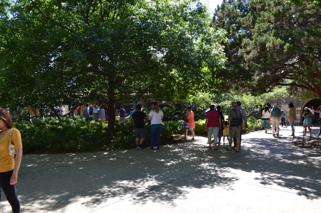
Around the south end of the Long Barrack, you’ll see the Alamo church. But we’re not going to stop there now; we’ll come back to it later. Right now, we’ll go through the gate to the left and into the Mission’s Convento Courtyard (See map #12).
During the mission period, the mission Indians would have worked in the rooms that surrounded this courtyard. They would have been doing tasks such as spinning yarn, candle making, and other chores needed for the mission. At the time of the battle, this area was in ruin, with most of its rooms gone. It’s believed that it was here that the Alamo garrison kept their horses, and it’s also thought that there was a small cannon placement at its northeast corner.
The Big Tree
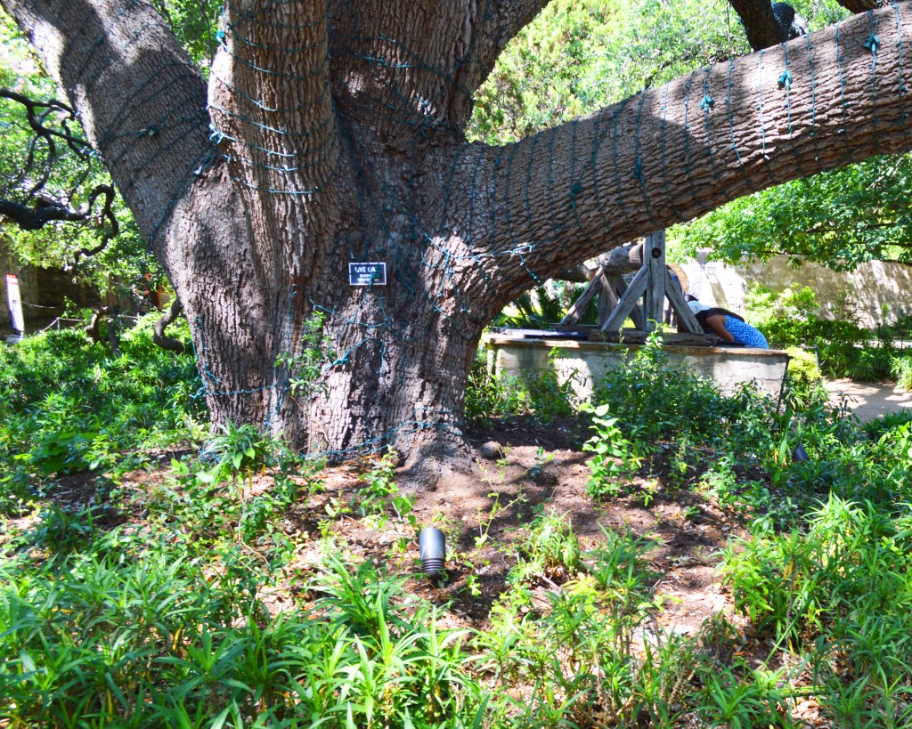
Today, this courtyard is a peaceful garden. In the middle is a large Live Oak tree that visitors call “the Big Tree.” This tree wasn’t there during the battle; it was brought and replanted there in 1912 by local resident Walter Whall. The tree was 40 years old and already fairly big when it was moved and replanted there. It took four mules to pull the cart with the tree from Whall’s property to the Alamo. The most challenging aspect of the move was avoiding the power and telegraph lines on their way to the Alamo.
The Mission’s Well
Next to the “Big Tree” is an old dry well. This is said to be a modern reconstruction of the well at Mission San Antonio de Valero. But there’s some debate as to the authenticity of this well. Some sources I’ve read say this is a non-historical feature added much later. This theory is based on maps drawn by Alamo witnesses: Mexican Lieutenant Colonel José Juan Sánchez-Navarro and Alamo engineer Green B. Jameson, which don’t show a well at that location. However, both of those maps were tactical battle maps, and showing a well would not have been needed.
In Mark Lemon’s book, The Illustrated Alamo, he shows a well at that location. Lemon had done considerable research and must be confident that there was indeed a well there. But again, what would the Alamo be without a little more controversy?
Shigetaka Shiga Monument to the Alamo’s Heroes
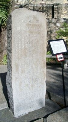
Off in a corner of this courtyard is an often-overlooked monument to the Alamo’s fall. This 4-foot-tall gray granite stone has an inscription in Japanese, Chines, and English that reads, “To the Memory of the Heroes of the Alamo.”
Dedicated on November 6, 1914, it is the oldest monument to the Alamo’s heroes. It was personally created and donated by Japanese scholar Shigetaka Shiga and features a poem by Shiga himself. The poem compares the bravery of the Alamo defenders with that of the 16th-century Siege of Nagashino Castle, another battle in which a few hundred defenders, badly outnumbered, fought against thousands.
The Monument to the Gonzales “Immortal Thirty-Two.”
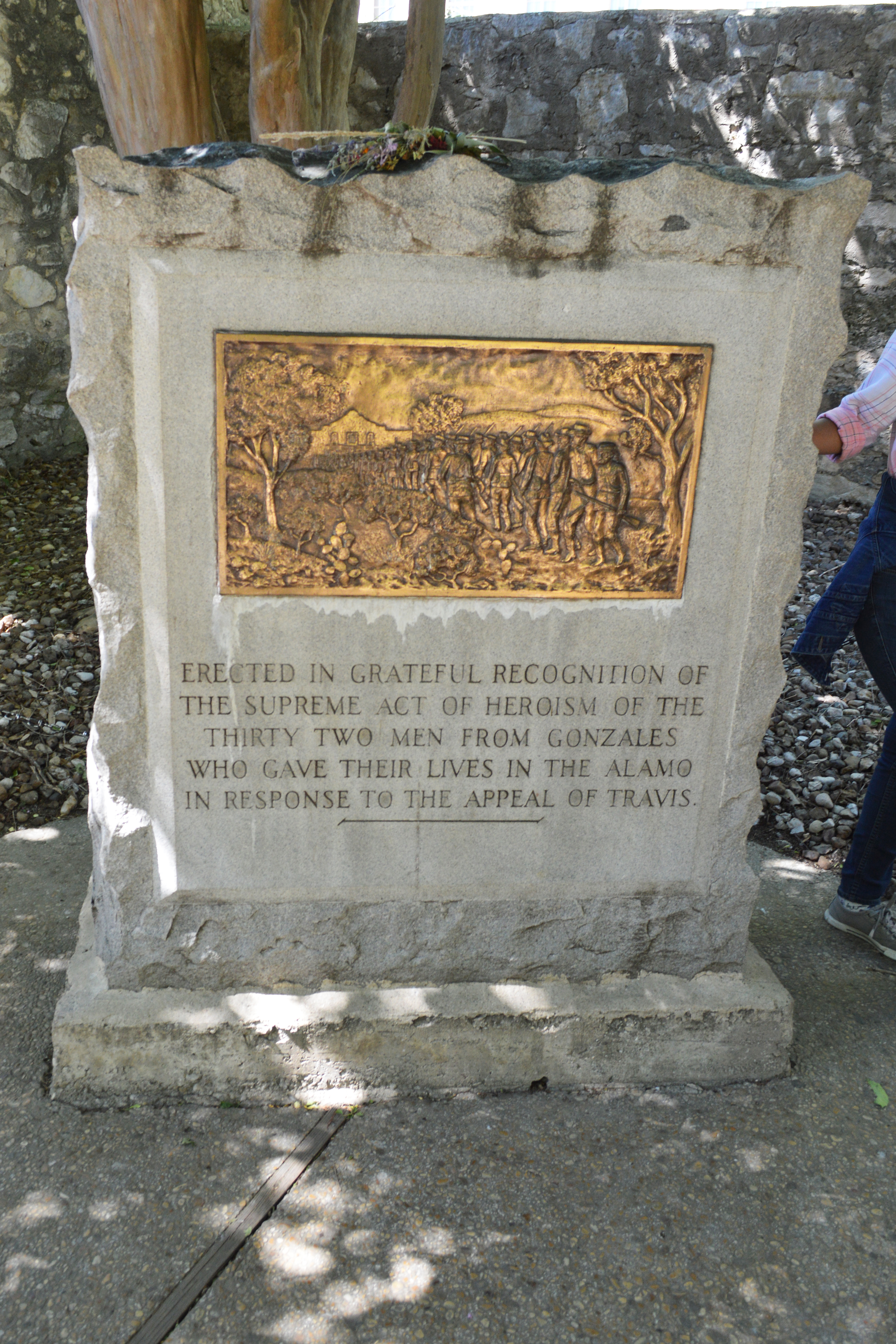
There’s another monument in this courtyard you need to see. This is to the Gonzales “Immortal Thirty-Two.” On the evening of March 1, 1836, thirty-two men from the town of Gonzales rode through the Mexican lines coming to the aid of their fellow Texans. This monument is located on the north side of the courtyard.
As you look at the Long Barrack on the courtyard side, remember
that these walls are reconstructions of the originals. However, archaeologists
have recently discovered that when those reconstructions took place, they did use
the original foundations.
At the south end of the Barrack is the entrance to the current Alamo museum. When the new museum is completed on the west wall, you can only wonder what will occupy this historic structure.
We’re now going to leave the old Convento courtyard and go over to the fort’s other courtyard.
The Northern Courtyard
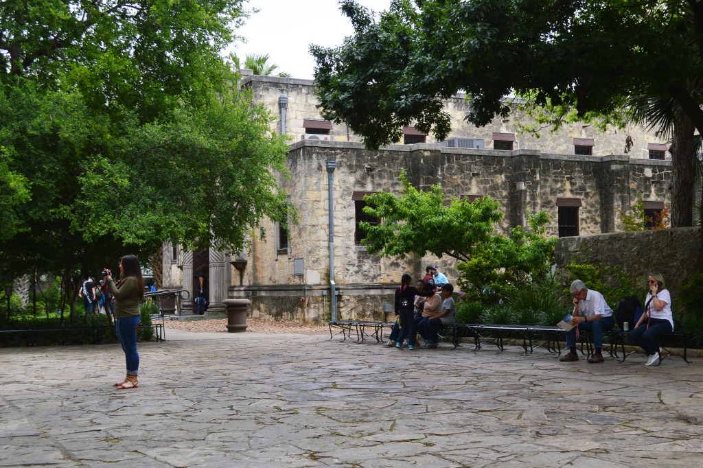
The name for this courtyard varies depending on what source you read: In Mark Lemon’s book, he refers to it as the Northern Courtyard, and Alan C. Huffines calls it the Cattle Pen in his book The Blood of Noble Men, and on the Alamo’s official website they refer to it as the Cavalry Courtyard (See map #13).
During the 1836 battle, it’s believed that the defenders kept the cattle that fed the garrison, as Huffines stated. This courtyard was also one of the weakest areas of the fort, where its walls were only about four and a half feet high. Accounts state that during the battle, this section was defended by a small 4-pounder cannon placed at its eastern corner. However, even with the low wall and small artillery piece, the defenders were able to hold off the attacking Mexicans, driving them further to the western end of the north wall.
The Statues of Heroes


Currently, the Cavalry Courtyard is displaying the “Statues of Heroes.” Here you’ll see six sculpted bronze statues of David Crockett, William Travis, Jim Bowie, Susannah Dickinson holding her daughter Angelina, as well as other historical figures of the Texas Revolution. Sculpted by artists George Lundeen, Glenna Goodacre, Chris Navarro, Deborah Fellows, Enrique Guerra, Bruce Green, and others, they are part of “the Alamo Sculpture Trail,” which goes from the Alamo to the Briscoe Western Art Museum.
The wall that separates this courtyard and the Alamo’s grounds from Houston Street isn’t where the fort’s original wall stood; that’s a foot further north on the street side. There’s a marker on the sidewalk that indicates the original boundary line.
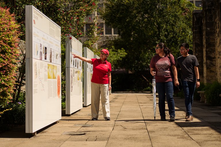
As you leave the Northern Courtyard, look for the Wall of History (See map #14) next to the Alamo gift shop. The Wall of History is a long and colorful chronology of the Alamo’s history, beginning with its mission period.
The Alamo Gift Shop
Although the Alamo gift shop (See map #15) looks like an original building, it’s not. It was also built in 1937 for the Texas Centennial. It was first used as a museum on the history of Texas’s independence, and then later converted by the Daughters of the Republic of Texas (DRT) to the present gift shop.

Here’s a cute little story. In the 1985 Tim Burton movie, Pee-Wee’s Big Adventure, Pee-Wee Herman travels to the Alamo looking for his lost bicycle. He’s told that he’d find it in the Alamo’s basement. However, when he arrives, to his disappointment, he’s told that the Alamo doesn’t have a basement. Well, that’s not exactly correct if you’re looking at all the property as the greater Alamo.
In 1992, the Daughters of the Republic of Texas (DRT) hired G.W. Mitchell Construction to excavate a basement under the Alamo gift shop. Completed in 1993, this basement houses gift items, supplies, and an employee break room.
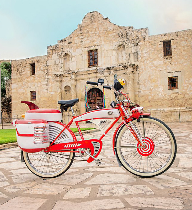
Although Pee-Wee’s bike isn’t in the Alamo’s basement, the actual bike used in the movie has been purchased by the Alamo.
We’re now going to leave the courtyard areas and journey behind the Alamo church.
The Ralston Family Collection Center
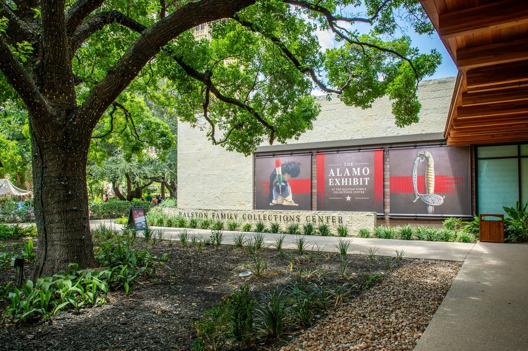
Next to and to the east of the Alamo gift shop is the Ralston Family Collection Center.
This building is on the battlefield where Mexican Col. Romero’s men attacked the east side of the Alamo.
Today the Center holds the Phil Collins and the Donald and Louise Yena Collections.
Slaughter Outside the Alamo
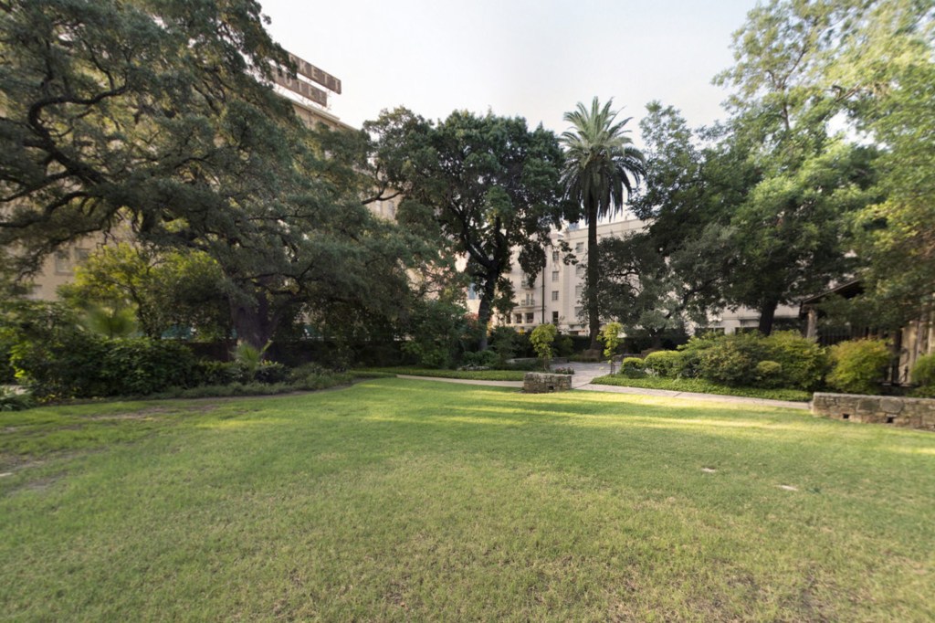
In my 2014 post, I told how the back of the Alamo church was completely different from what it is today. During the battle, there wasn’t a roof or windows; in fact, the wall of the church’s apse was considerably lower. It was in the ruined church’s apse that a platform had been built, at about twelve feet in height. Atop this platform were placed three cannons. This allowed the defenders to cover the ground behind the fort very effectively.
Although not usually noted, the cannons on the platform and in the area behind the Alamo’s church (see map #16) would play both heroic and tragic roles in the battle for the Alamo.
On the morning of March 6th, 1836, Santa Anna’s army began their attack on the Alamo. Colonel José María Romero’s mission was to storm the east side of the Alamo. Leading 300 men, Romero charged the rear of the church and the low-walled Convento and northern courtyards. Here, he encountered heavier-than-expected resistance from the defenders’ small arms and cannon fire. This caused Romero to fall back and also drift to the north, where he would eventually mix with the forces attacking the Alamo’s north walls.
However, even with Romero’s men now to the north, there was still a Mexican presence in that area. At a short distance from the fort was the Dolores Cavalry, patiently waiting for their time. Their mission was to apprehend any defender who tried to escape. And that time soon came.
As Santa Anna’s men worked their way southward through the fort, a group of defenders tried to make a break for it through a narrow opening between the church’s southwest corner and the wooden palisade. As they ran to the southeast across the open field, they soon met the Mexican cavalry.
Even with supportive fire from the cannons at the back of the church, these men were soon cut down. Men on foot have little chance against mounted cavalry. It should also be said that although these defenders tried to escape the massacre, accounts by the Mexican’s say they fought bravely to the end.
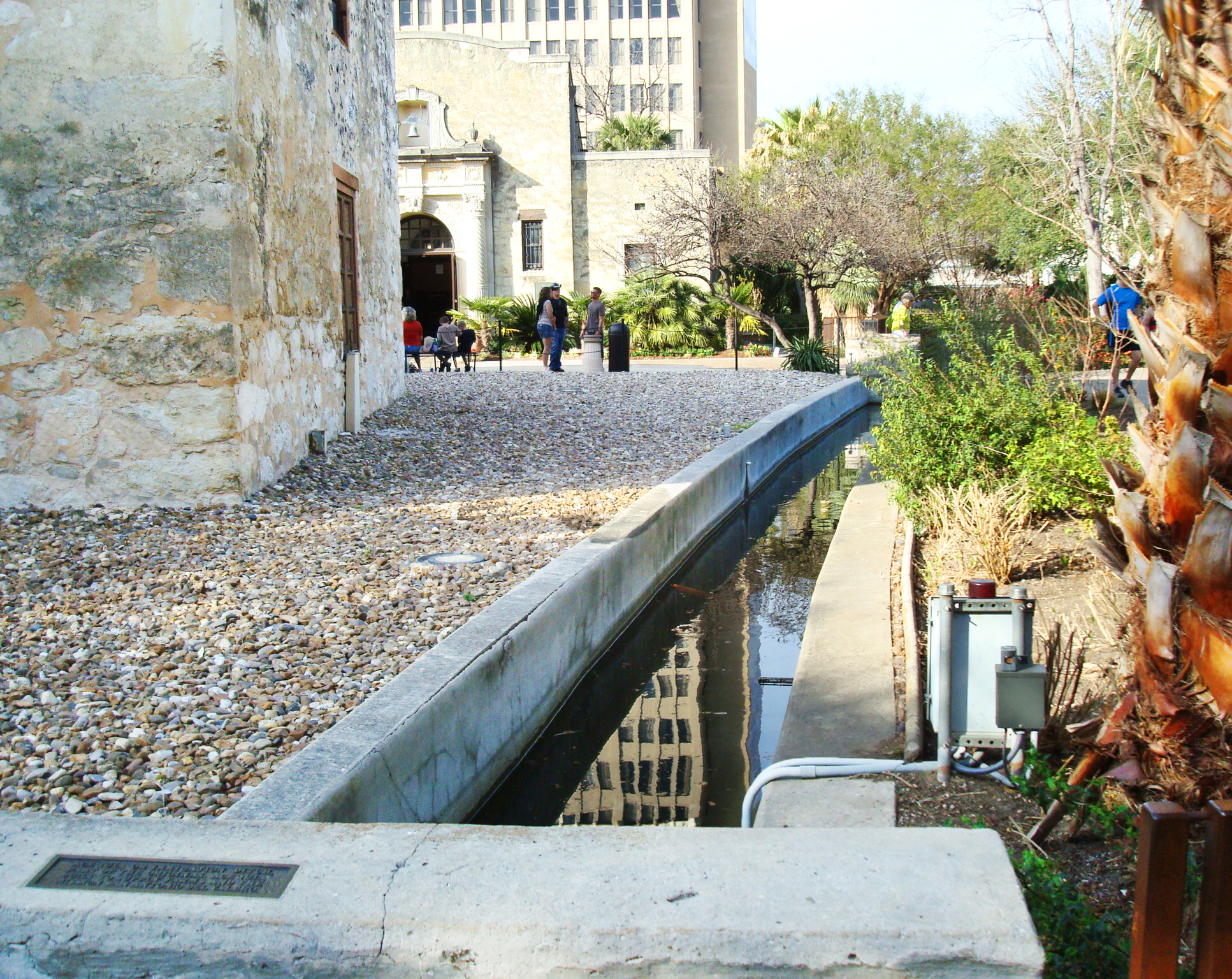
We’ll now walk along the south side of the Alamo church, heading back to its front. Running along the back of the church, you’ll see what looks like a water-filled ditch. This is what remains of the Acequia Madre, also known as the Acequia del Valero or Acequia del Alamo. This was part of a network of irrigation canals that watered the fields when the Alamo was a mission. This system of canals was so extensive that archaeologists have found traces of it in the parking lot of St Joseph Church on E. Commerce Street.
Continuing to walk along the south side of the Alamo church, you’ll see on your right the new Texas Cavaliers Education Center. This state-of-the-art multimedia student learning center sits on the site of the former Alamo Hall and Daughters of the Texas Revolution (DRT) library.
The Alamo Cannon Display
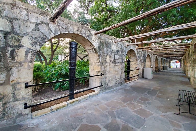
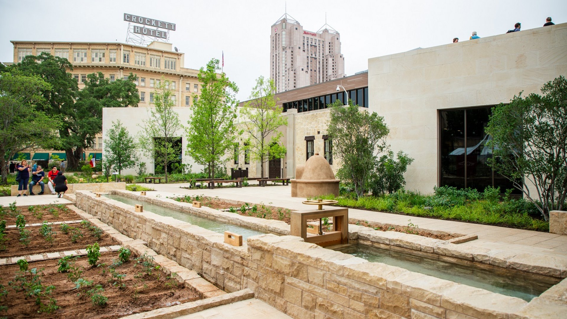
Just before you reach the front of the church, you’ll walk under a stone arcade. Although this may look like the original structure of the Alamo, it’s not. It was built in the 1930s by the DRT. When I was there in 2018, this arcade was used as a queue for those waiting to enter the Alamo church. But today it’s used to display newly restored cannons, many of which were used in the Battle of the Alamo by its defenders.
As you look at these cannons, you’ll notice that some are damaged. This is because Mexican soldiers rendered them inoperable after the Battle of San Jacinto, so they couldn’t be used by the Texians. Also, many of these cannons were the ones discovered buried by Samuel Maverick, where the Hotel Gibbs sits today.
In Front of the Alamo Church
There are quite a few spots around the front of the Alamo church (see map #17) that I’ll be pointing out. The first is the place where David Crockett and his men from Tennessee defended.
“Crockett’s Palisade”
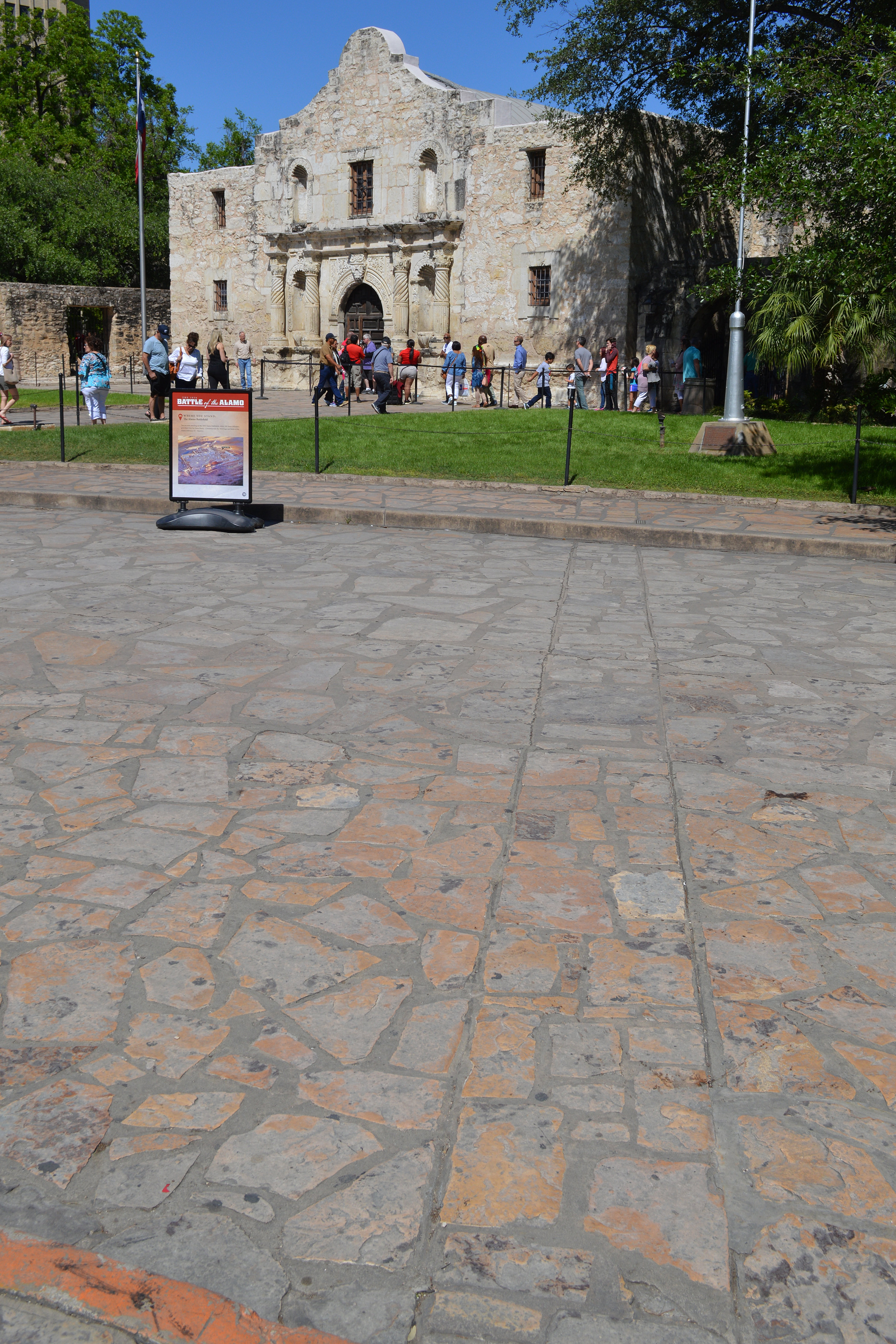
It’s believed that Crockett had manned this long wooden palisade, which ran from the southwest corner of the church to the southeast corner of the main gate; the Low Barrack building stood there. This is often referred to as “Crockett’s Palisade” (See map #18).
To see where this palisade had been, cross over the closed E Alamo Street and look back toward the church. On the street, you’ll see in the pavement a line going towards the church. This would have been the location of “Crockett’s Palisade.”
The Palisade Exhibit
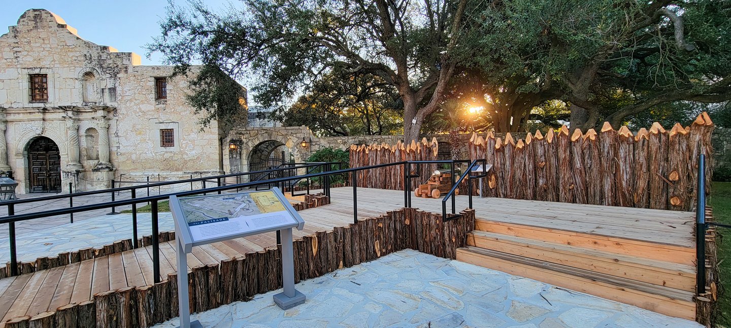
In December 2021, to help visualize what this defensive position might have looked like, a partial re-creation was built at the approximate location of the 1836 original palisade.
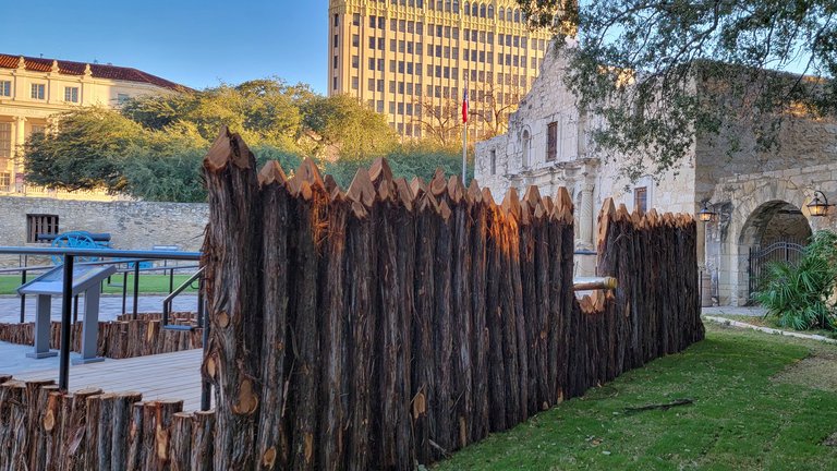
This display is constructed of vertical cedar posts, a hardwood ramp, and decking, on which a replica of a 4-pounder bronze cannon is mounted.
The Kitchen and Low Wall
There was another, often-overlooked building and wall that also helped close off this area in front of the church. The building angled north off the east side of the Low Barrack and served as the garrison’s kitchen during the battle. From that building, running north to the Long Barrack was a six-foot-high stone wall (See map #19).
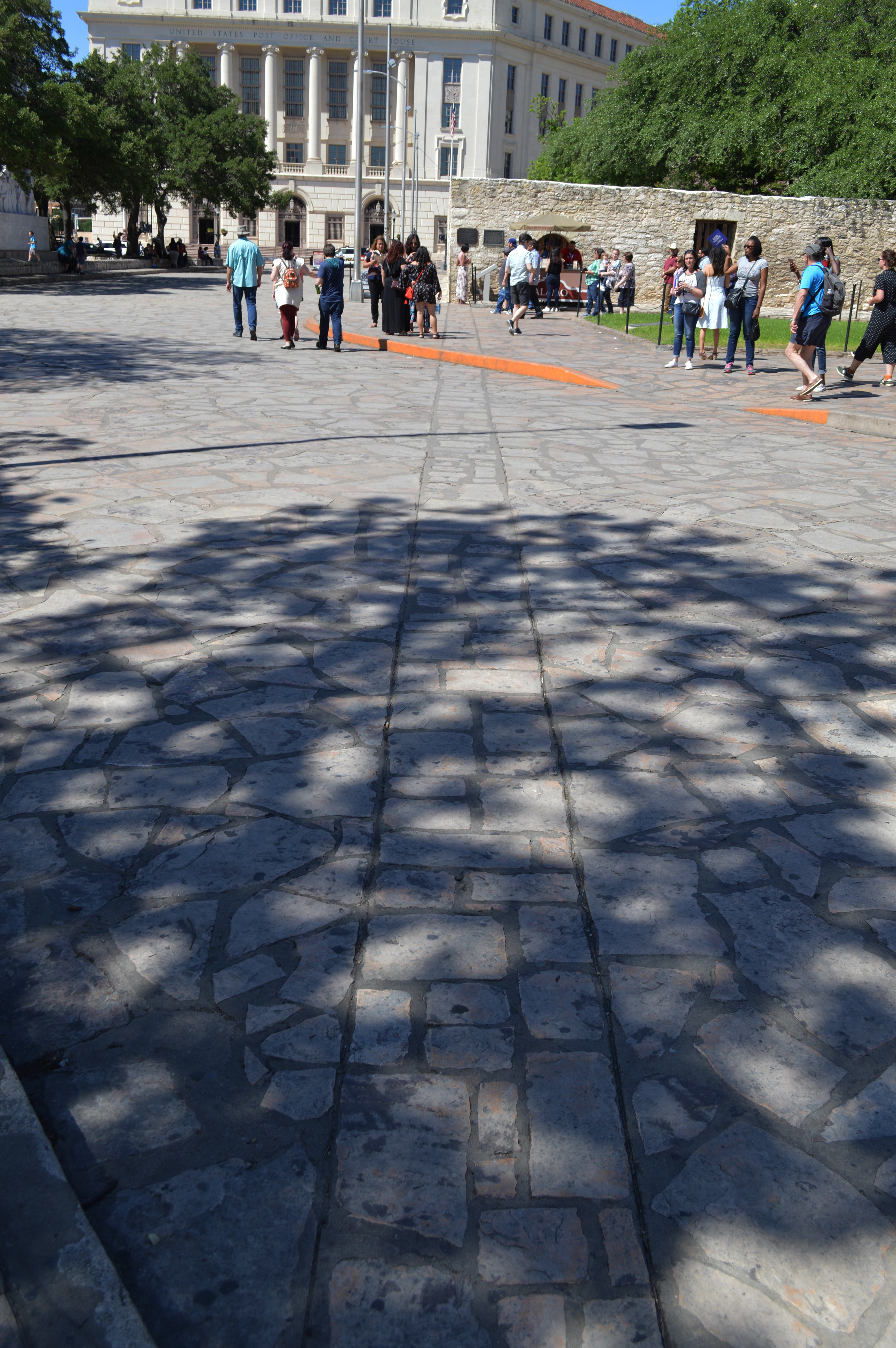
This wall and building, along with the wooden palisade and Convento wall, would have separated this section of the fort from the rest of the compound. It may have been this area that Alamo survivor Susannah Dickinson was referring to as “the little fort” in an interview.
Again, to know where the kitchen and this low wall had been, look for the lines in the pavement heading toward the Long Barrack.
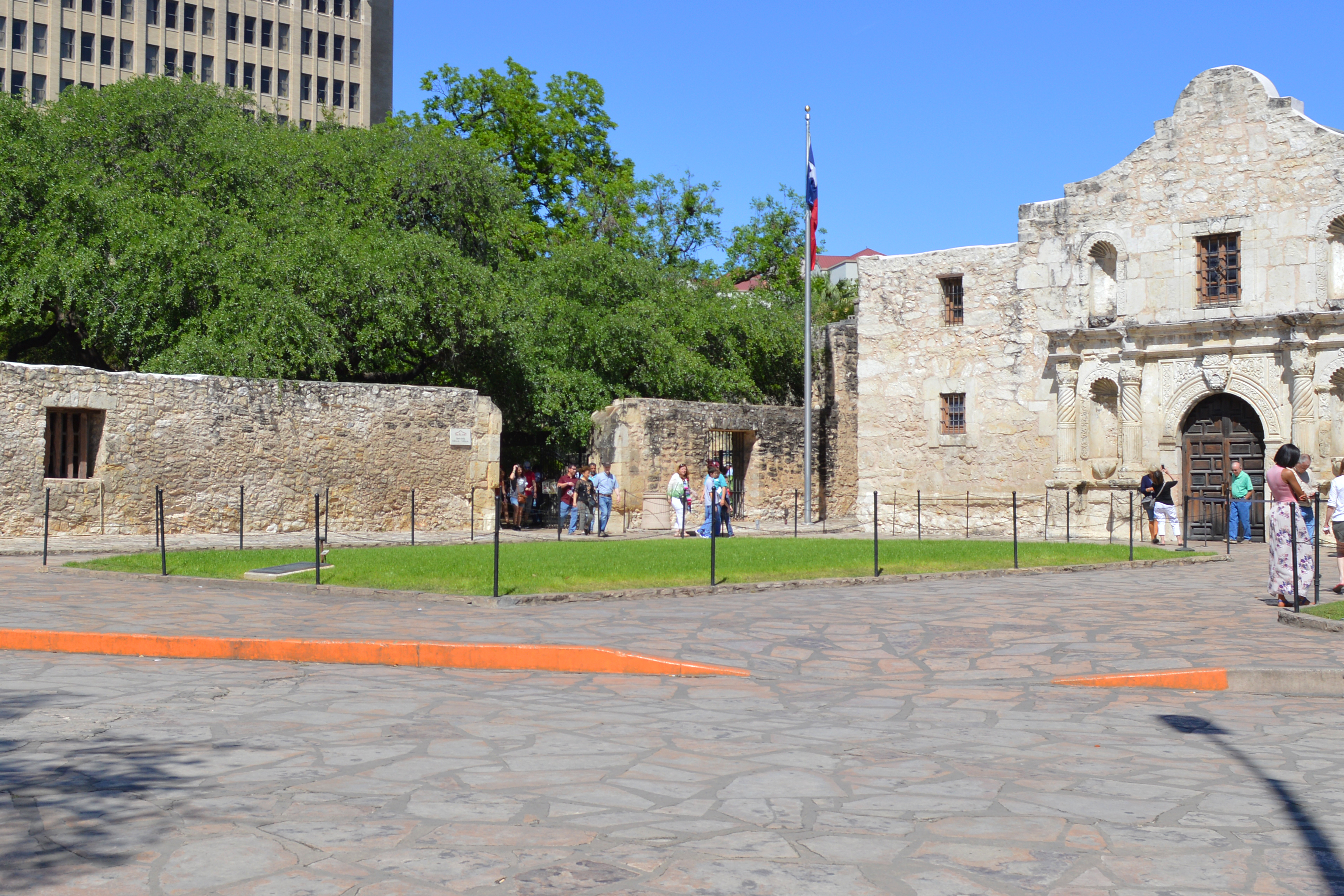
We’re now going back to the church and the large rectangular grassy area in front of it (See map #20). This is another historical spot that is largely overlooked and unrelated to the battle. I was told that this grass area was installed by the DRT to remember the mission’s Priests and Indians who were buried there when it was the mission’s “Compo Santo,” or cemetery. Mission records show that nearly 1,000 burials had taken place on the grounds of the Alamo. After the mission was secularized and abandoned in the late 1700s, it’s not recorded if those remains were ever relocated or simply forgotten.
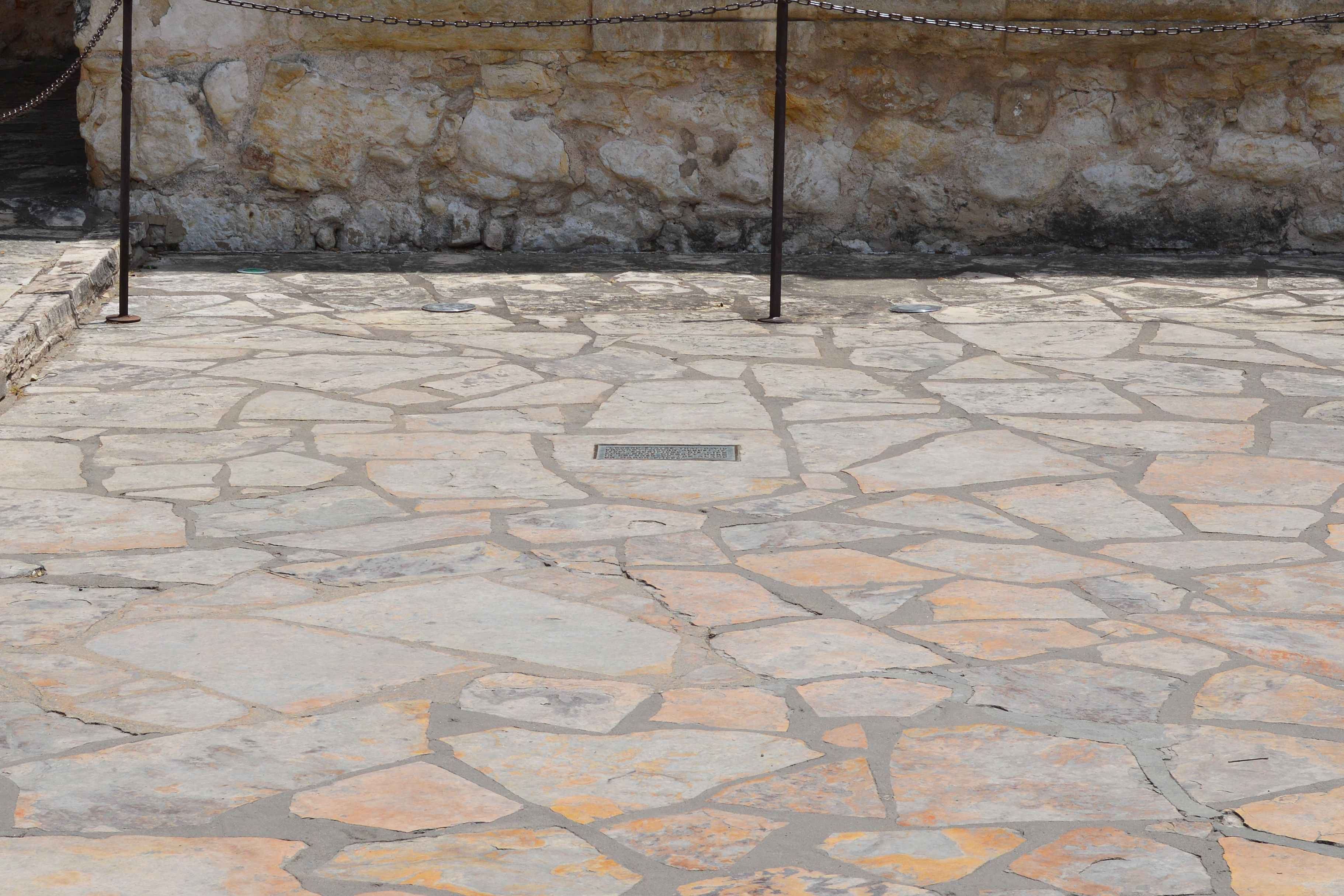
Near the church’s front door, on the right side (see map #21), you’ll see a metal plaque in the plaza stones that reads,
LEGEND STATES THAT DAVID CROCKETT (BORN AUGUST 17, 1786) SACRIFICED HIS LIFE FOR TEXAS LIBERTY HERE IN DEFENSE OF THE ALAMO ON MARCH 6, 1836.”
Although this may not be the exact location where Davy Crockett died, it is in the general area described by Susanna Dickinson, as she left the church after the battle.
“I recognized Colonel Crockett lying dead and mutilated between the church and the two story barrack building, I even remember seeing his peculiar cap lying by his side.”
Susanna Dickinson
As you stand there close to the church’s façade, look closely. Those pockmarks you see on the façade are from musket balls, another sign of the terrible fighting that took place there.

Before we leave this area in front of the church, there’s another marker I want you to look for. This marker also has a thin brass rod embedded near it (See map #22). The marker says that it was at that location that Travis drew his legendary line in the sand. However, Travis’s line remains more of a myth and legend than a historical fact. And if Travis’s noble event did take place, there is no record that it happened at that location.
Sites on the South End of the Alamo Compound
The Low Barrack and the Alamo’s Main Gate
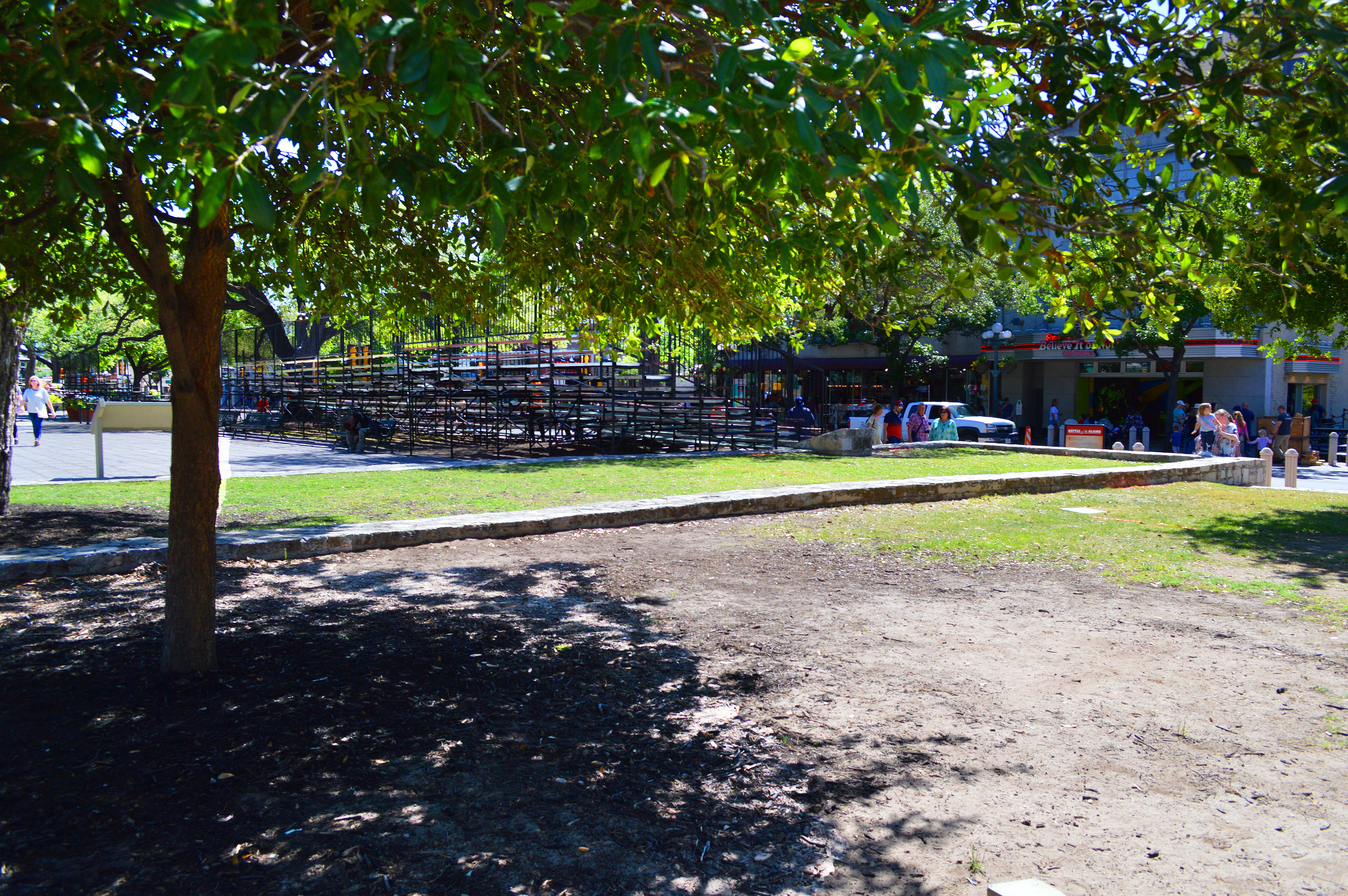
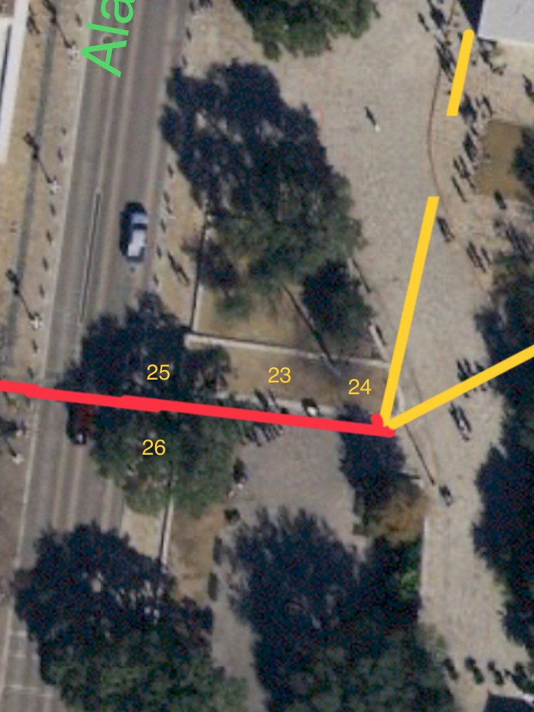
We’re now going to leave the front of the Alamo church and walk over to where the Palisade and the Low Wall lines meet on the closed E Alamo Street. There, in 2018, was a large rectangular, stone-bordered, grassy area (See map #23). This is where the building, known as the Low Barrack, once stood.
The Low Barrack measured 131 feet long and 17 feet high, with walls two to two and a half feet thick. The building had three rooms, with the eastern room being what is believed to be where James Bowie was killed (See map #24).
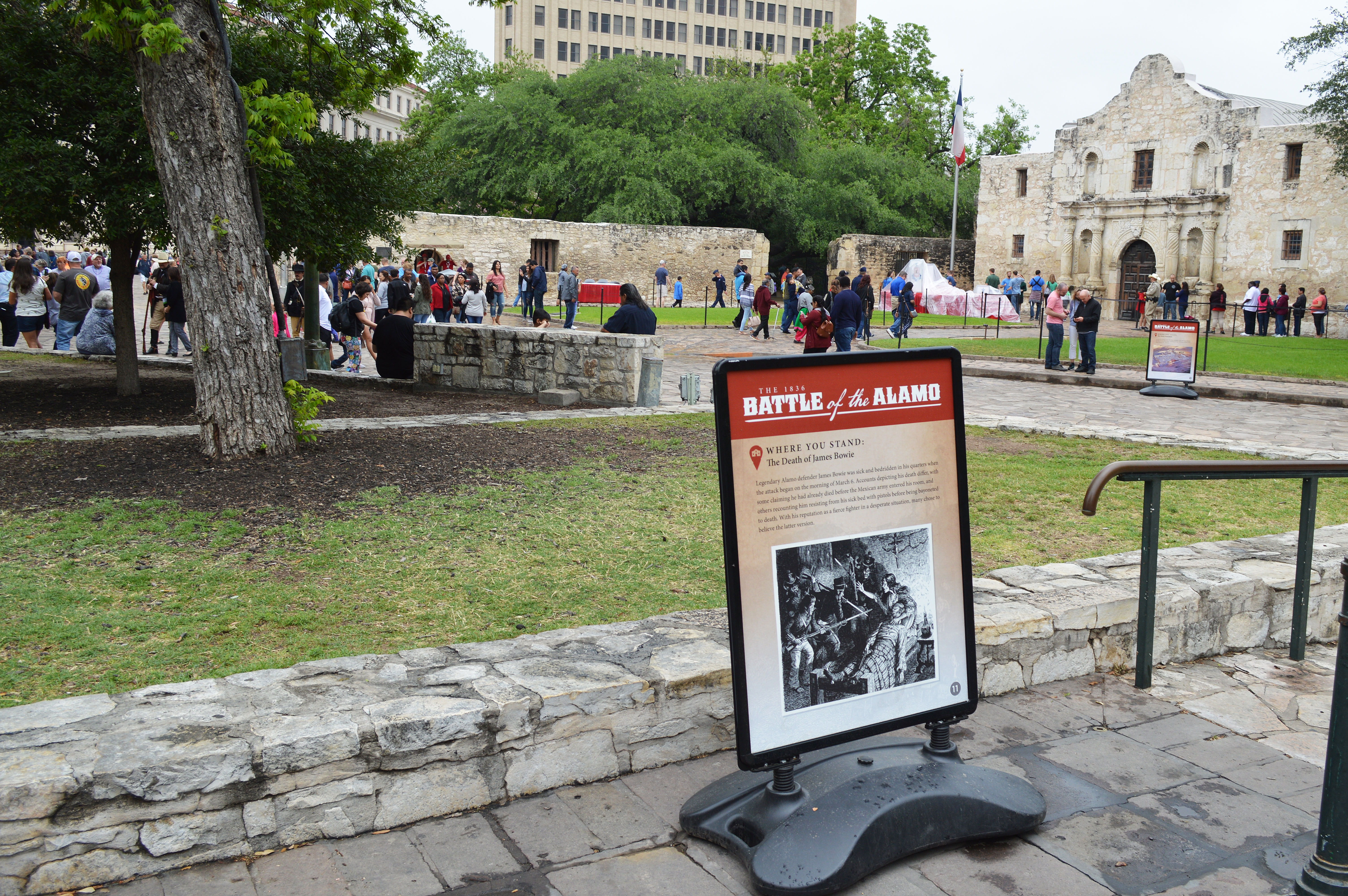
The Low Barrack also had the fort’s main gate (See map #25). This made up the Alamo’s south wall.
Just outside the main gate stood a structure that helped guard it. This was a wooden-and-earthen lunette (See map #26). This lunette was destroyed by the Mexican army, along with the fort’s connecting walls and cannon, after their defeat at San Jacinto.
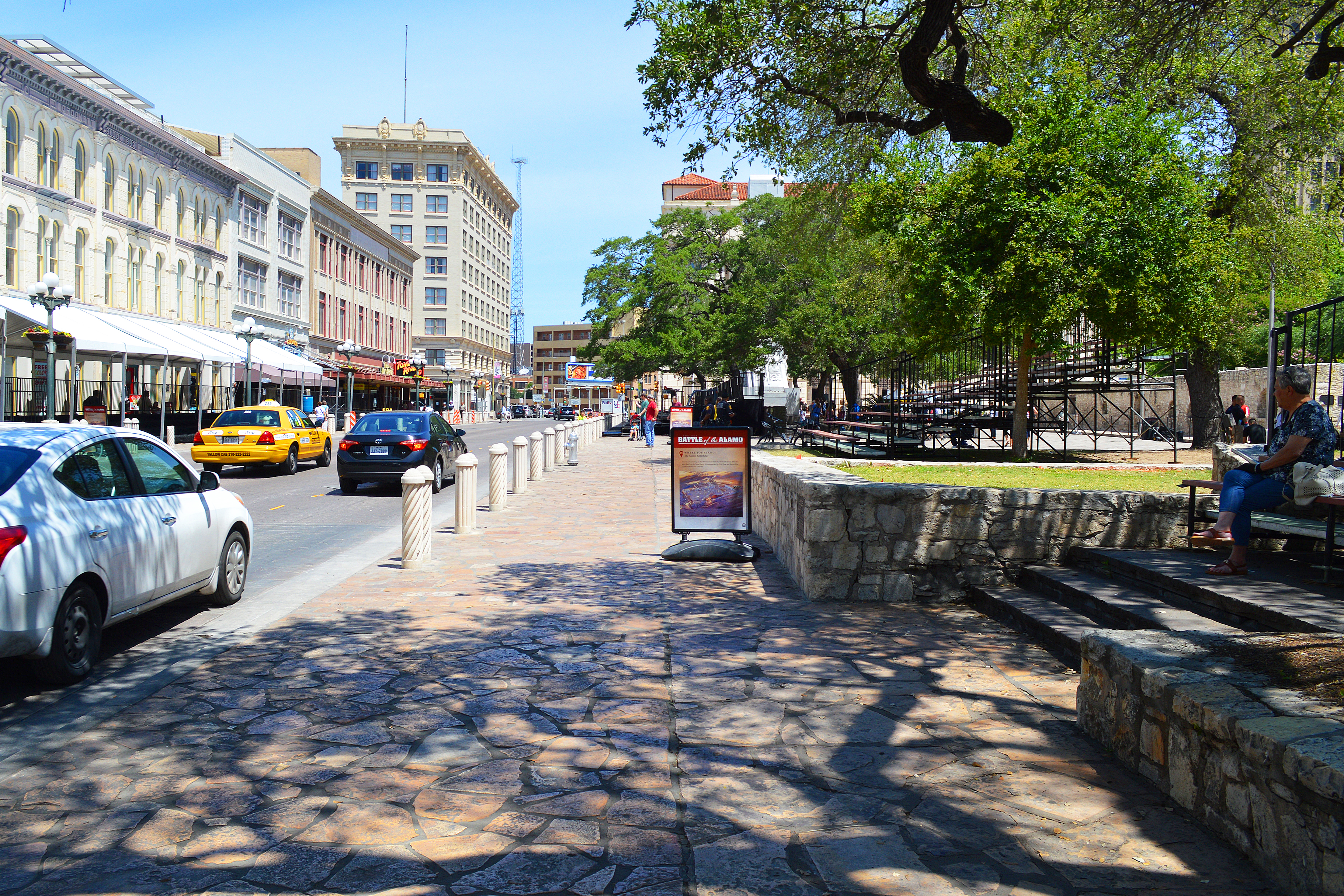
Although this lunette was indicated on the map drawn by Mexican Officer José Sánchez-Navarro, it wasn’t believed to have been very big or important. However, in 1988, an archaeological dig at the site revealed that this lunette was most likely very substantial in size and importance. Although the exact dimensions still need to be uncovered by future explorations, it’s believed that it ran roughly seventy-two or seventy-three feet to the south of the Low Barrack, and about sixty-three feet east to west.
Mission Gate and Lunette Exhibit
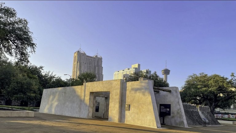
In May of 2024, a key piece of the Alamo’s story was opened to the public: the Mission Gate and Lunette exhibit.
Sitting on what was the fort’s south boundary, this exhibit is not a reproduction of the original Low Barracks, but rather a stylized interpretation created by San Antonio artist Carlos Cortes.
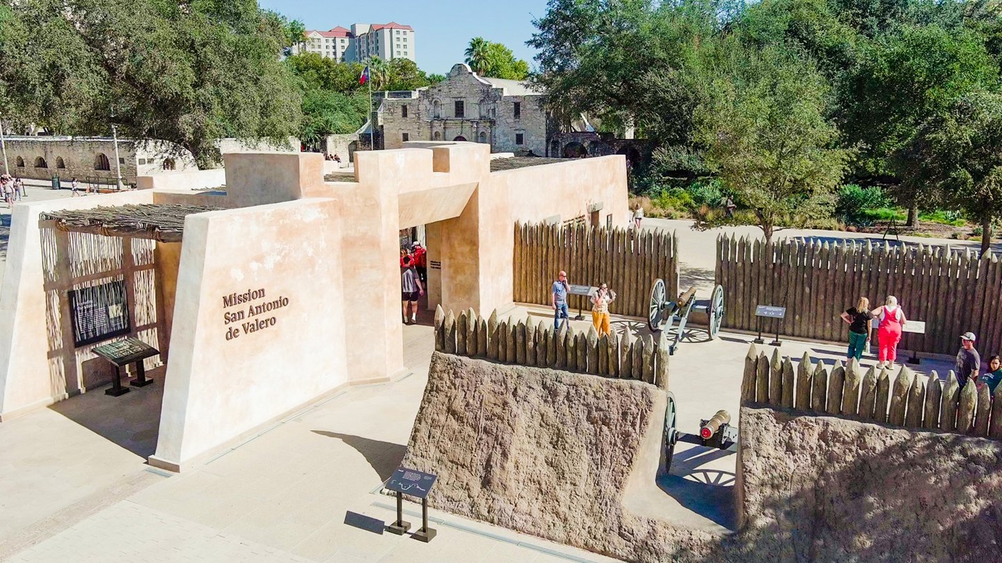
In addition, this exhibit is actually 20 feet further east than the original Low Barracks building. The reason is that the original footprint would have extended out into what was Alamo Plaza Street. This interfered with the annual Battle of the Flowers Parade. As a compromise, the Texas General Land Office (GLO) and the Alamo Trust (ATI) constructed this exhibit further east than the original structure.
Keeping Up with Discovering the Alamo
With all that going on at the Alamo, you need a resource that continually updates its programs and exhibits, and that is the Alamo itself.
For what to see in your visit, I suggest: thealamo.org/visit/whats-at-the-alamo.
But best of all, become a “Friend of the Alamo”, thealamo.org/membership.
My next post will explore the historical sites that are beyond the Alamo’s walls.
Sources used:
“18 Pounder Cannon.” The Alamo, The Alamo, http://www.thealamo.org/visit/whats-at-the-alamo/18-pounder-connon. Jan. 2022.
“18-Pounder Losoya House Exhibit.” DO210, DO210, do210.com/events/2021/4/16/18-pounder-losoya-house-exhibit. Jan. 2022.
“Alamo Palisade Exhibit Grand Opening on December 17.” The Alamo, The Alamo, 10 Dec. 2021, www.thealamo.org/alamo–trust/pressroom/alamo-palisade-exhibit-grand-opening-on-december-17.
Current, Ron “The History of the Alamo, Part 1: From Mission to Fort.” Still Current: The adventures and misadventures of a would-be historian., Word Press, 29 May 2017, stillcurrent.blog.
Current, Ron. “The History of the Alamo, Part 2: From Fort to Forgotten.” Still Current: The adventures and misadventures of a would-be historian., Word Press, 9 June 2018, stillcurrent.blog.
“History Comes to Life With Outdoor Alamo Exhibit on April 16.” The Alamo, The Alamo, 9 Apr. 2021, www.thealamo.org/alamo-trust/pressroom/history-comes-to-life-with#:~:test=History%20will%20come%20to%20life,Alamo%20Plaza%on%20April%2016.
Huffines, Alan C. Blood of Noble Men, The Alamo, Siege & Battle. First Edition, Eakin Press, 1999.
Kirkpatrick, Dean. The Alamo Story and Battleground Tour. First Edition, NDK Publications, 2013.
Lemon, Mark. The Illustrated Alamo 1836, A photographic Journey. State House Press, 2008.
Nelson, George. The Alamo, An Illustrated History. Third Revised Edition, Cenveo Printing Company, 2009.
“Palisade.” The Alamo, The Alamo, http://www.thealamo.org/visit/whats-at-the-alamo/palisade. Jan. 2022.
Texas Public Archaeology Network. “1719 Acequia Madre and the Alamo Dam.” Texas State, Texas State University, txpan.txstate.edu/Projects/History-of-the-Witte-Memorial-Museum/1719-Acequia-Medre.html. Feb. 2022.

